Pont Saint-Louis
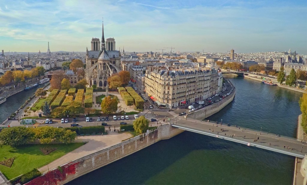
Pont Saint-Louis as it currently exists is the 7th in a series of bridges to link Île Saint-Louis to Île de la Cité. There was also a time when two bridges linked the islands, but more on that below.
The first bridge to cross the channel in the Seine between the two islands was called the Pont de Bois. Some sources put the date of construction of that bridge at 1614, but the 1615 map of Mathieu Mérian shows no bridge, indicating that construction on the first bridge between the islands most likely began later. The 1630 map of Tavernier clearly shows a bridge linking the two islands.
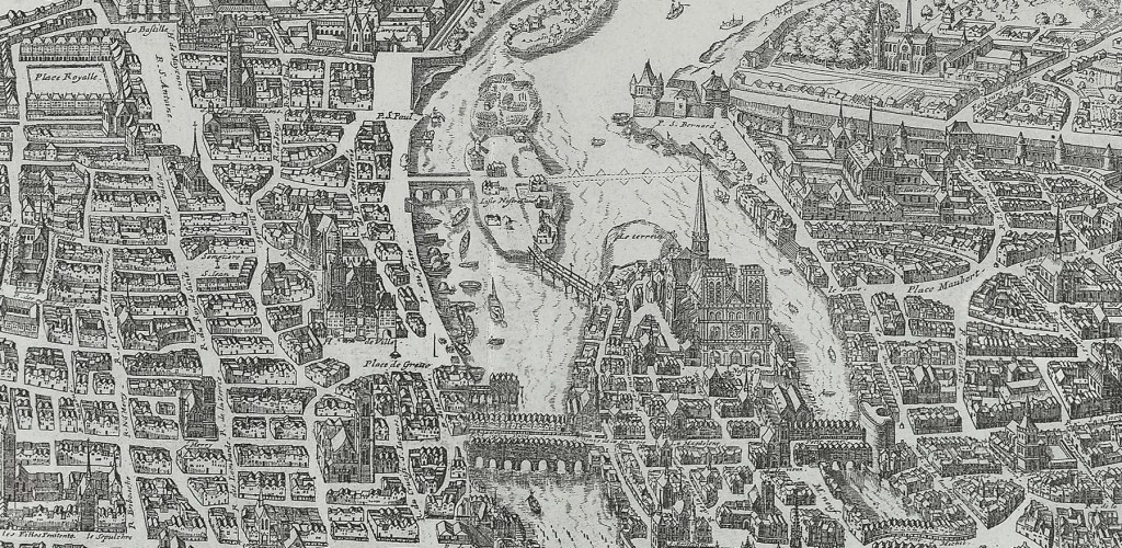
Internet searches also put the name of the first bridge between the two islands as Pont Saint-Landry, but maps of the period by Nicolas de Fer (1647 & 1697), Jacques Gomboust (1652) and Boisseau (1648) all indicate the name of the first bridge as Pont de Bois. This first bridge ran from the western tip of Île Notre Dame at the end Quai de Bourbon to the port Saint-Landry near rue des Chantres on the opposite shore.
One of the most interesting things about the first series of bridges was how they got their shape. The span, which was accessible only to pedestrians and had no houses on it, had a unique curve at its western end that owed itself to the jealousy of the Chanoines of Notre Dame. They had never been happy about the development of Île Saint-Louis, and indeed one of their demands to the development of the island was that the waterway between the two would never be filled in, so when the bridge was first begun it could have easily crossed the Seine directly, but the canons objected, seeing as the bridge’s terminus would be land that at that time was a garden of the church. So the bridge curved along the edge of the eastern end of Île de la Cité and terminated near the end of rue des Chantres instead of running directly across.
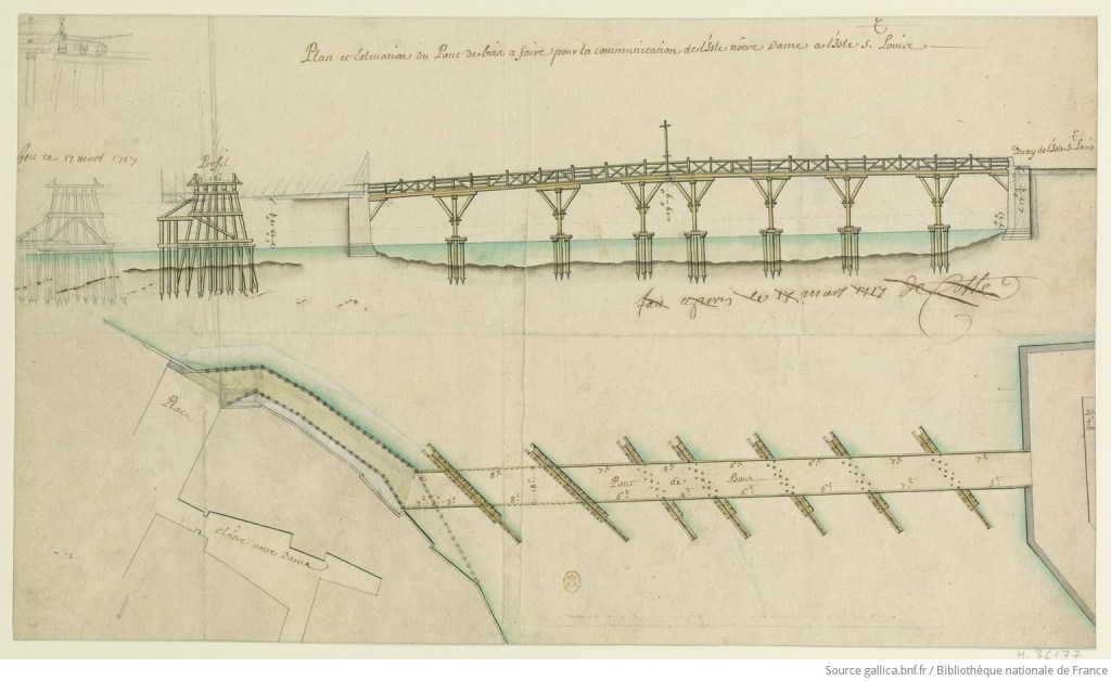
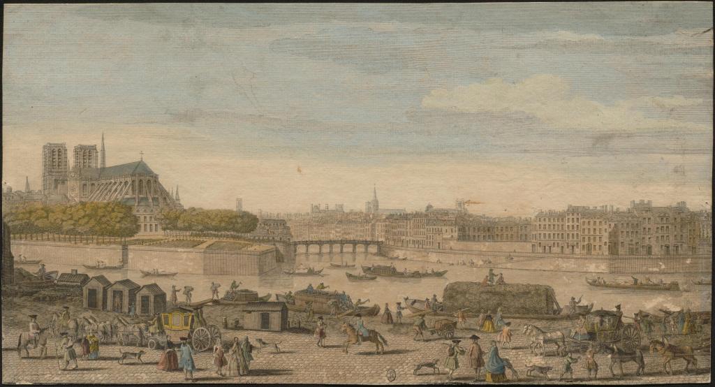
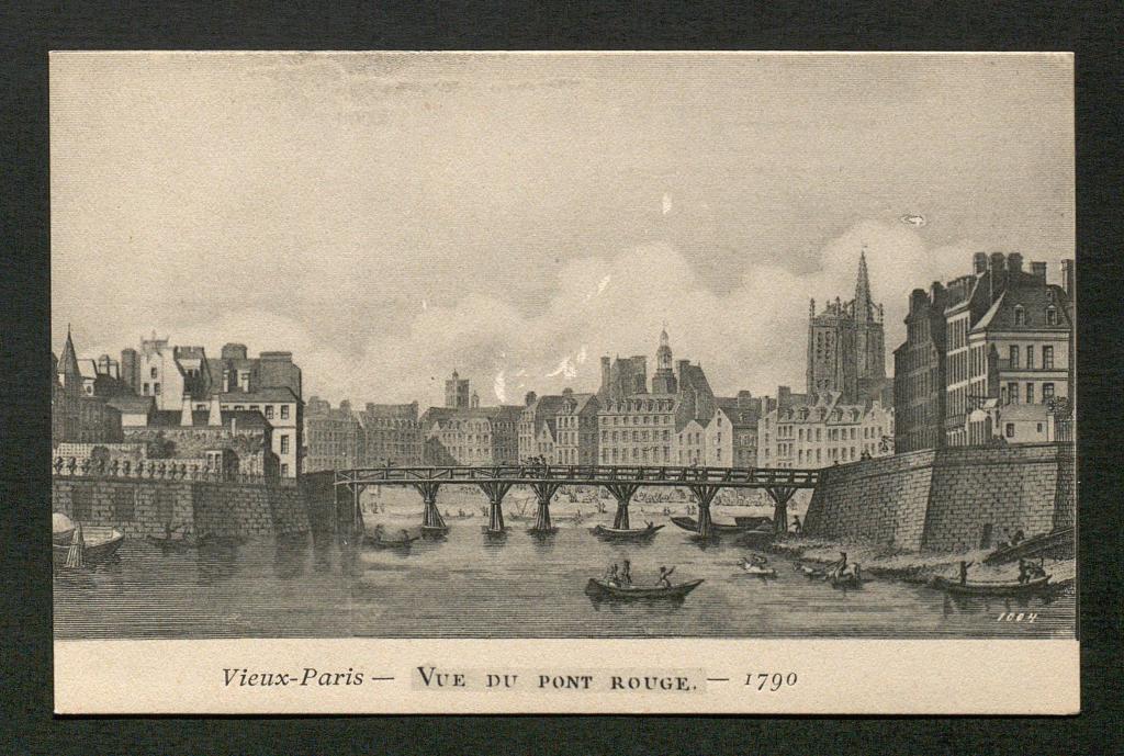
The bridge was destroyed by flood and rebuilt several times until it was replaced in 1717 by a wooden bridge that became known as Pont Rouge. That bridge was painted with minium, also known as red lead or red lead oxide, and this pigment gave the bridge its distinctive color and hence its name, Red Bridge. That bridge was finally removed in the latter part of the 18th century.
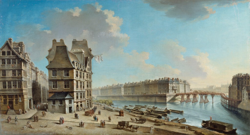
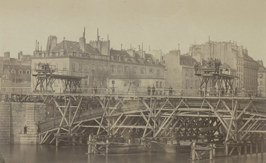
After that point maps of the period indicate that the bridge was relocated to its current position where a series of new bridges evolved in the 19th century. A wooden span was built in 1804 and then demolished in 1811. It was replaced by a suspension bridge in 1842, and then replaced by a metal span in 1862 which was later demolished in 1939.
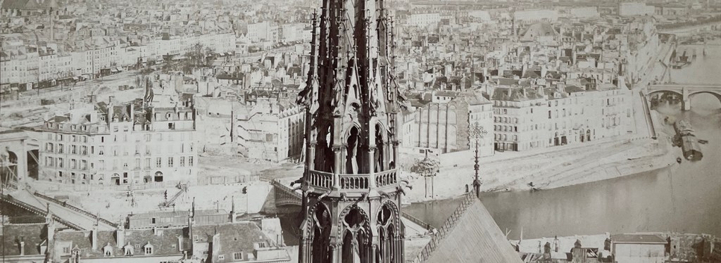
It’s worth noting here that Pont Louis-Philippe originally ran from the right bank through the western-most tip of Île Saint-Louis to Île de la Cité. (You can see part of the span of Pont Louis-Philippe in the lower left hand corner of the photo above.) So from the 1830’s to 1860 there were two bridges linking the two islands across the channel.
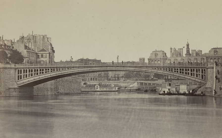
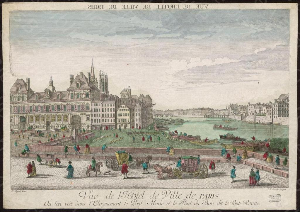
The bridge of 1862, shown above, was replaced by a metal span in 1941 that was built like an iron cage.
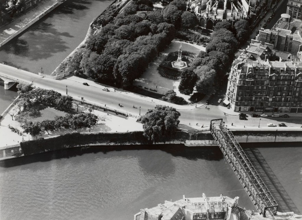
The above bridge was replaced by the current span which was begun in 1968 and completed in 1970.
