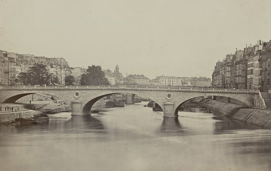
Pont Louis-Philippe
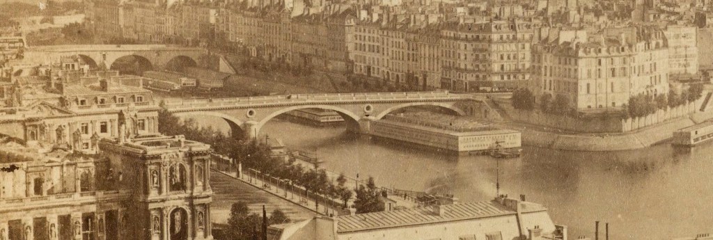
The Pont Louis-Philippe we see today crossing the Seine linking the Rue du Pont Louis-Philippe to the island at what is now Rue Jean du Bellay is not the original bridge that first linked the island to right bank at the Quai de l’Hôtel de Ville.
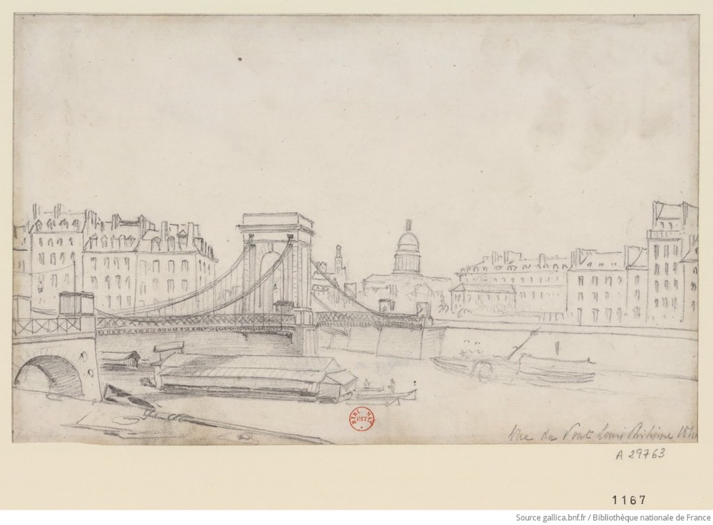
The original bridge ran from its current northern point at Quai de l’Hôtel de Ville diagonally across the Seine to the westernmost tip of Île Saint-Louis, at what is now Place Louis Aragon, crossing the Seine again and terminating at the Quai aux Fleurs on Île de la Cité, thereby linking both islands to the Right Bank.
Rue du Pont Louis-Philippe was cut through the neighborhood on the Right Bank as part of the plan for the original bridge, but Rue Jean du Bellay on Île Saint-Louis was created later when the original bridge was repositioned and rebuilt in its current form in the 1860’s.
The stone for the first Pont Louis-Philippe was laid in 1833 to celebrate King Louis-Philippe’s (b. 1173 – d. 1850) accession to the throne in 1830. The Séquin brothers, the creators of France’s first railway and pioneers of a suspension bridge system, were given a financial grant to build the bridge, but they assumed any additional costs in exchange for the right to charge a toll for a period of 49 years. The bridge took a year to build and was opened to traffic on the 29th of July, 1834.
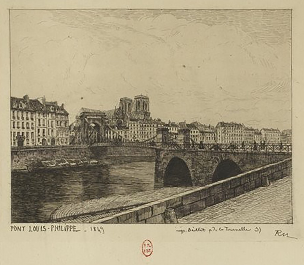
The first bridge didn’t have a very long life. It was partially destroyed during the Revolution of 1848, but it was quickly rebuilt and renamed Pont de la Réforme until 1852, and tolls were not reinstated on the reconstructed bridge as many tolls were suppressed after the Revolution.
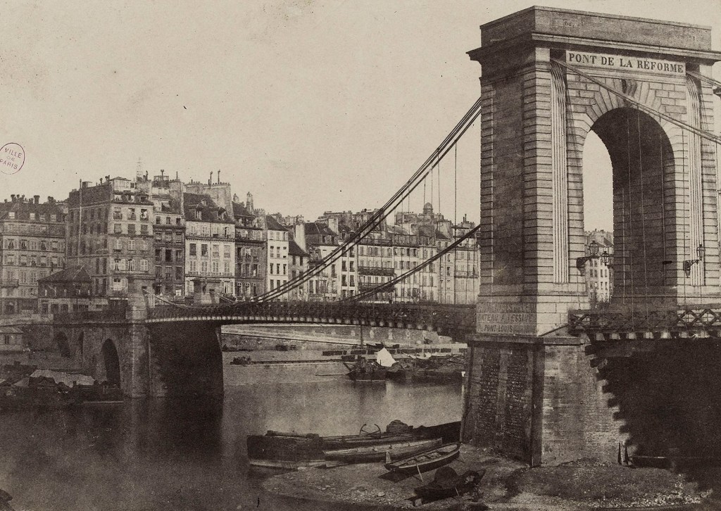
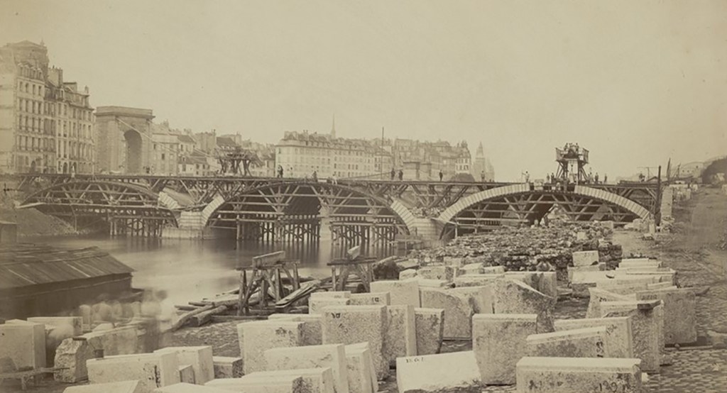
Traffic grew as a result of the suppression of the tolls, and the suspension bridge quickly became obsolete and was demolished in 1860 to make way for the current bridge. You can see one of the towers of the original bridge behind the construction of the current bridge in the photo below.
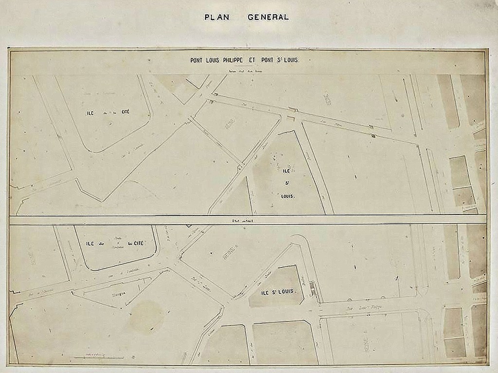
On the 1st of August, 1860 a decree was issued ordering the creation of the new bridge and also the replacement of the Passerelle de la Cité (now the site of Pont Saint-Louis). The decree also ordered the opening of a street (now Rue Jean du Bellay) linking the two bridges and cutting through what was once a densely packed residential block on the western end of the island.
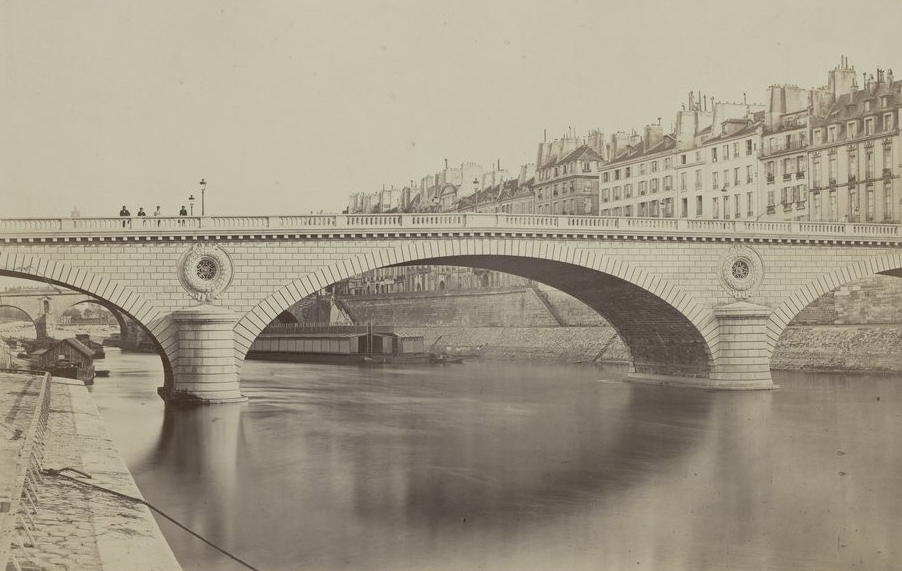
Work began on the new Pont Louis-Philippe at the end of August, 1860, and the completed bridge was opened to traffic in April of 1862.