History of the Island
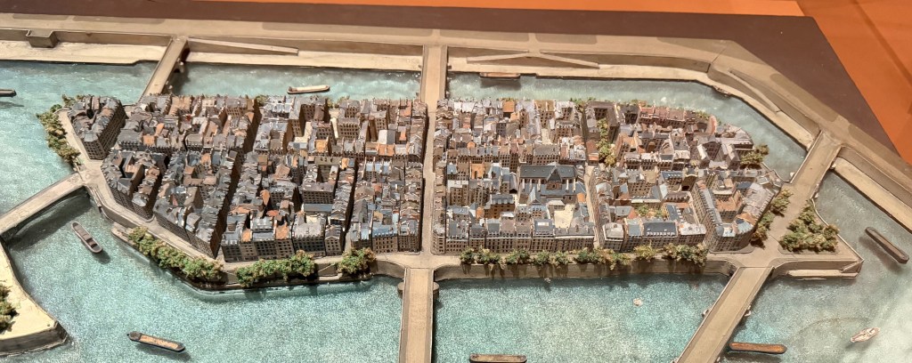
Île Saint-Louis remains much the same as it was when the island was developed in the first quarter of the 17th century, and the neighborhood is one of the few “quartiers” in central Paris that was largely untouched by George-Eugène Haussmann’s revisionary plans for the city in the 19th century. As such, the architecture and the street plan are, with small exceptions, much the same as they were when young King Louis XIII transformed a pastoral island in the Seine into one of the city’s most iconic neighborhoods.
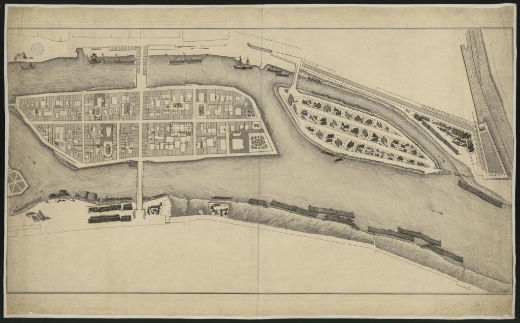
It’s hard to imagine a time when the neighborhood was a bucolic, sometimes flooded island in the Seine, but unlike it’s more famous neighbor, Île de la Cité, Île Saint-Louis escaped extensive development for almost 700 years in the center of a growing metropolis from its beginnings in the Gallo-Roman era. The Île Saint-Louis we see today (it didn’t take its current name until the latter part of the 18th century) was originally named Île Notre-Dame and remained so from ancient times through the Middle Ages. The island was divided in the 13th century as part of Philippe Auguste’s (b. 1180, d. 1223) vision to fortify the city with a protective wall. A trench was dug through the island forming two separate land masses, and chains were strung from the fort de la Tournelle on the left bank through ships and the new channel between the freshly divided islands to the tour Barbeau on the right bank of the Seine in order to fortify the river approach and strengthen the overall protection of the city’s walls. The larger of the two islands, which retained the name Île Notre-Dame, sat to the west, and the smaller of the two was named Île aux Vaches and sat to the east. Both islands remained separated that way for more than 300 years.
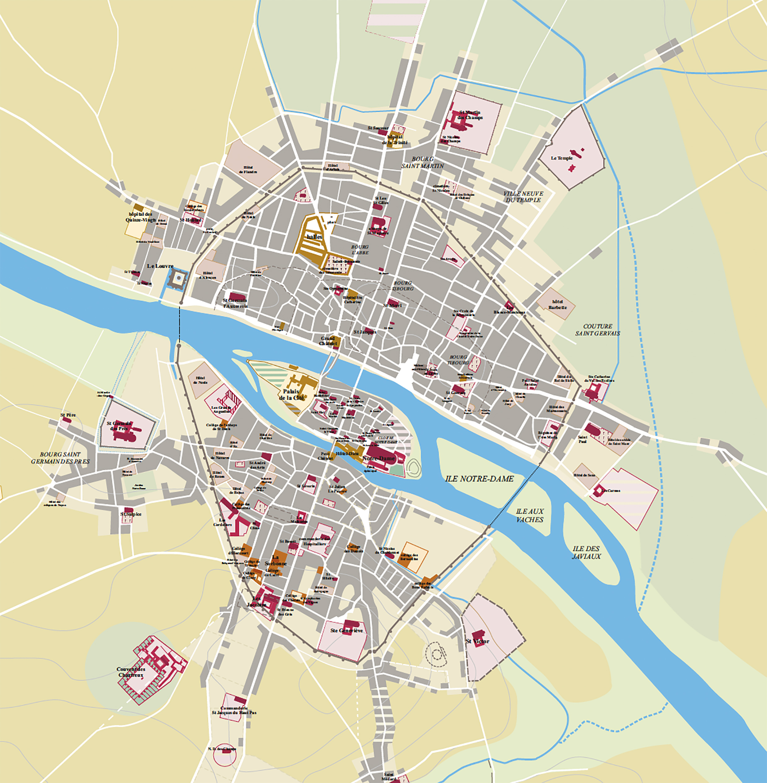
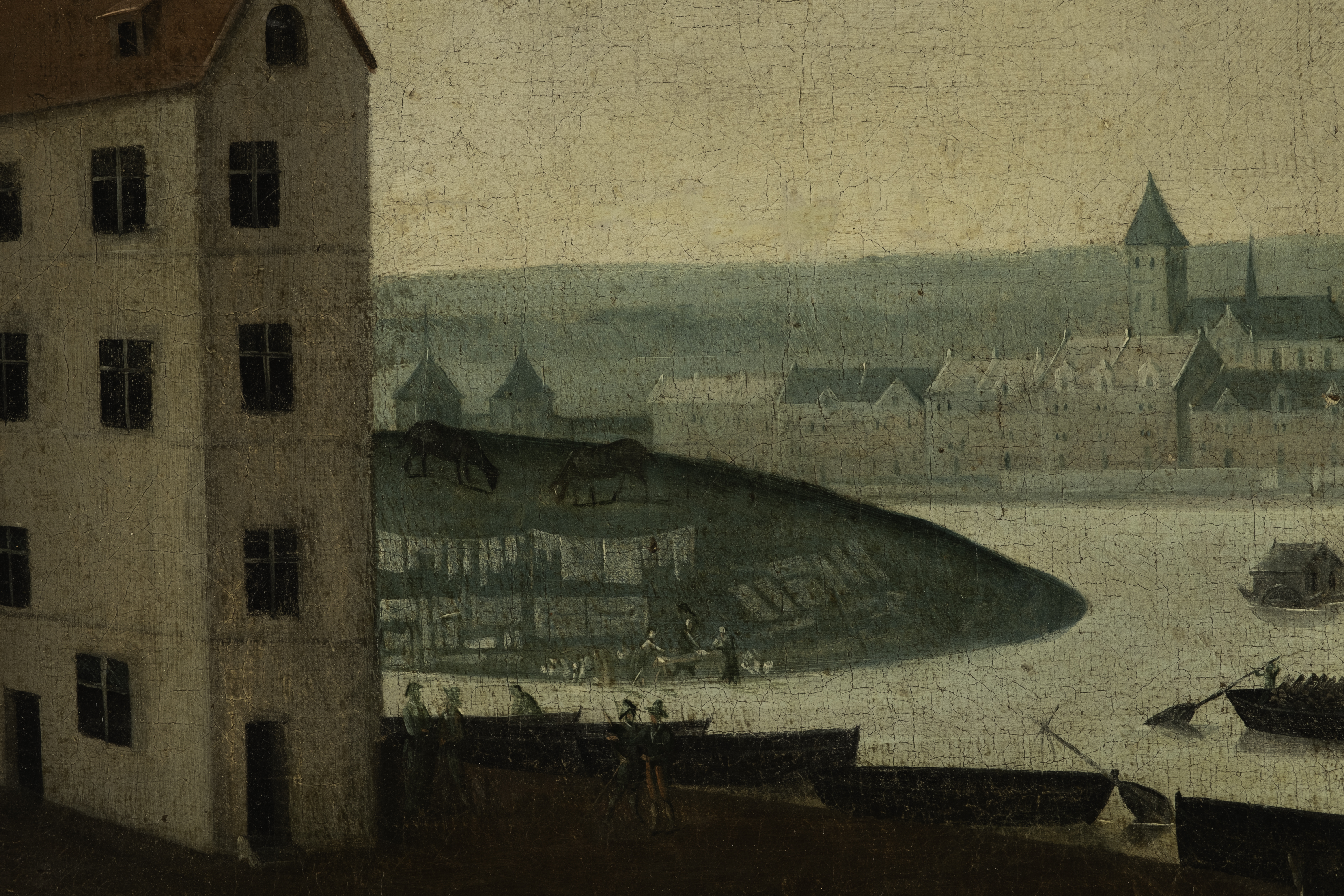
During that time the islands were used for grazing livestock brought over by boat or via the wooden Tournelle footbridge which was first constructed in 1369 and connected Île Notre-Dame to the left bank near the site of the current Pont de la Tournelle. Île aux Vaches was designated for storing wood and building boats, while both islands were popular with washerwomen, fishermen, boaters, archers and as sites for the occasional duel. There was also a lively tavern on Île Notre-Dame that was operated by the chapter of Notre Dame, which at that time had rights to the land, and by 1600 Nicolas le Jeune, a master roofer, had already constructed a small cottage on the island and attached a chapel to it that was dedicated to Saint Nicolas.
Talk to rejoin the islands began in the late 16th century as part of a series of development plans for central Paris begun by Henry IV (b. 1553-d. 1610) whose many public works projects included the Place Royale (Place des Vosges) and the Place Dauphine in Paris. The project was pitched to the King by Christophe Marie in 1609. Marie was known as an inventor and engineer who pioneered a wooden bridge system, and it was his idea to build bridges that would connect the growing Marais neighborhood to the left bank of the Seine utilizing Île Notre-Dame to connect the two, but Henry was assassinated by François Ravaillac before he could initiate Marie’s proposal.
It fell to Henry’s son, Louis XIII (b.1601-d.1643), and his mother, Marie de Medici functioning as regent, to push the project forward. A contract was finally signed on April 19, 1614 with Louis XIII, then age 13, and Christophe Marie giving Marie rights to reunite the islands into one and then develop the land. Marie, along with two partners, war commissioner Lugles Poulletier and François Le Regrattier, treasurer of the Cents-Suisses, were tasked with joining the islands, filling in the channel between them, constructing stone quais to reenforce the shoreline, laying out streets and building two bridges connecting the rejoined single island to the left and right banks in exchange for development rights to the land for 60 years. In order to finance all of the above work, Marie and his associates were authorized to build houses on the bridges and quais, construct a bathing house, mills and fishing huts, as well as a jeu de paume court.
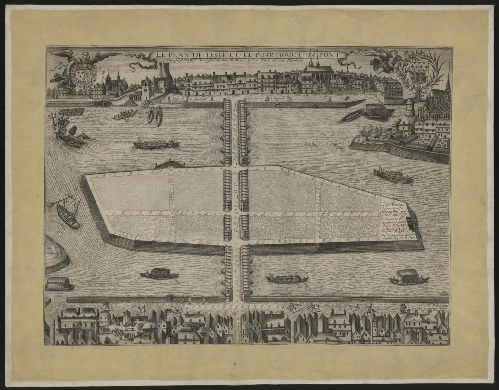
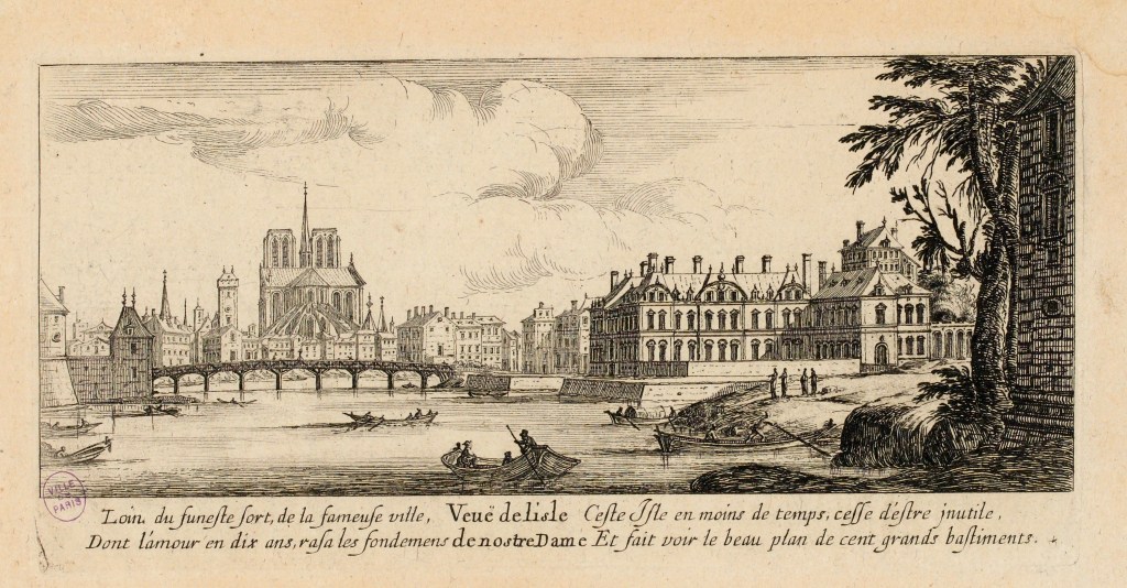
Two temporary wooden bridges were quickly constructed allowing work on the island to proceed, and tolls collected at the bridges provided income to partially finance the work. The stone for the first permanent bridge, Pont Marie, to connect the newly reunited “Île Notre-Dame” to the right bank was laid on October 11, 1614 by Louis XIII, and the bridge was completed in 1635. The bridge runs from the Quai des Célestins at rue des Nonnains d’Hyères in the Marais to the juncture between Quai de Bourbon and Quai d’Anjou on the island. Many bridges from the period allowed for the construction of houses along their span and Pont Marie originally supported two rows of houses with small shops on the street level that extended the length of the bridge on both sides connecting to perpendicular rows of houses that ran east and west along the Quai des Célestins on the right bank. The houses that ran along the last two arches of the bridge on the island side were swept away by a flood in 1658. The bridge was then repaired, but the houses that were swept away were not rebuilt, and the remaining structures on the bridge were removed in 1786 just before the revolution. Pont de la Tournelle which connects the island to the left bank was completed in 1656, but houses were never constructed on that bridge.
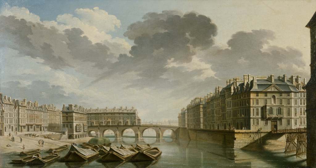
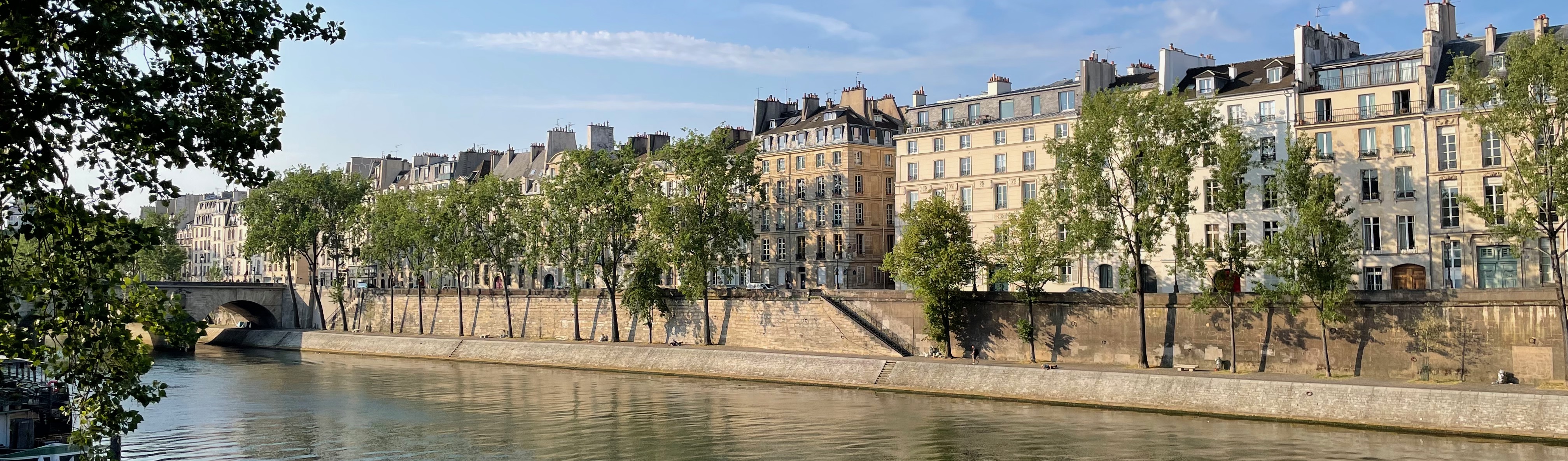
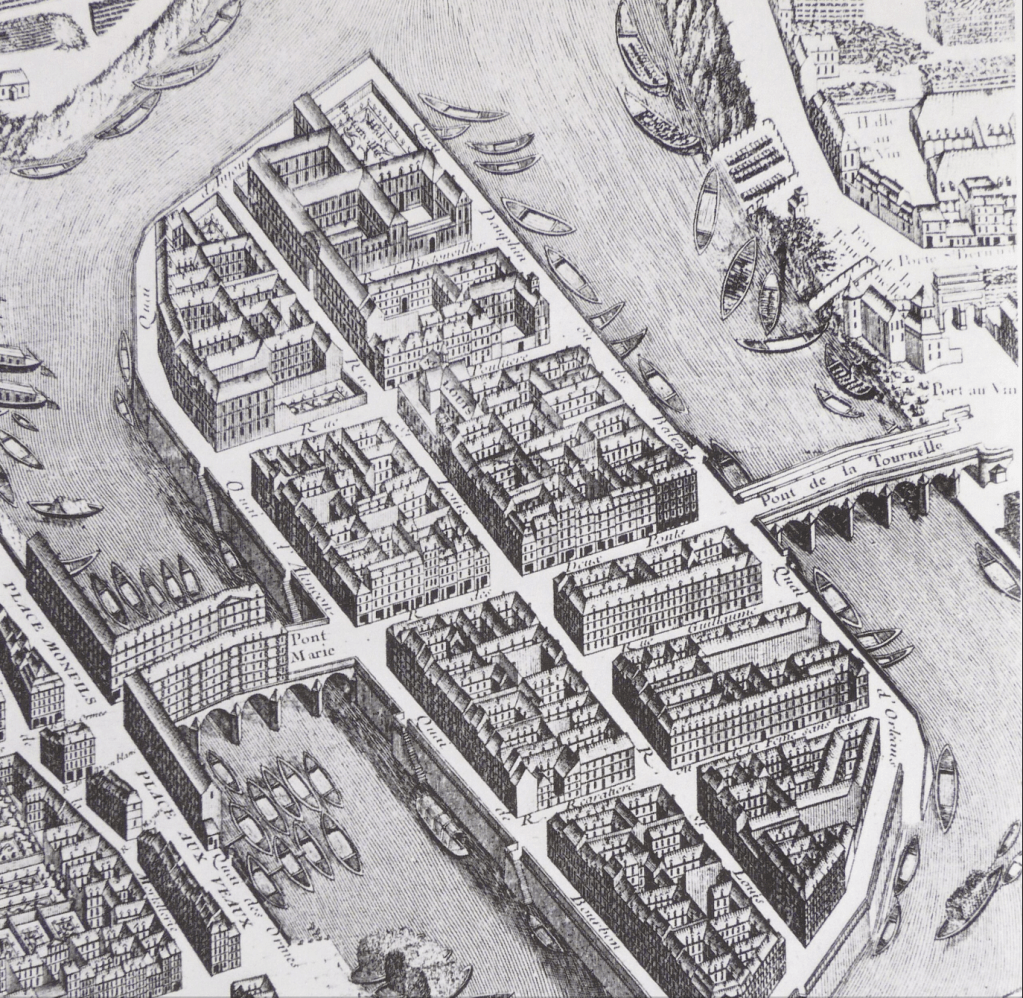
Once the temporary bridges were constructed, work on developing the island progressed fairly rapidly between 1620 and 1650. Quai de Bourbon, Quai d’Anjou, Quai de Béthune and Quai d’Orléans were all completed between 1614 and 1647, and magistrates, wealthy financiers and parliamentarians built large luxurious residences along the newly formed quais. These “hotels” were remarkable not only for their size and opulence, but also for the novelty of their design with windows facing outward toward the Seine. Rue Saint-Louis en l’Île became the island’s mostly commercial thoroughfare and the side streets were built up as master masons and craftsmen received plots of land as payment for their work on the island.
But things did not go smoothly for Marie and his associates. The project proved much more costly than anticipated and it created quite a bit of controversy. Sailors were vocal about their concerns that the bridges would create navigation issues on the river and cost them additional money and the canons believed that the newly constructed quais would change and increase the rivers currents and cause serious flooding endangering the shores of Île de la Cité, which at that time had no protective quais. In 1616 the Chapter of Notre-Dame filed suit against the developers which ended in a ruling by the King’s Counsel that compensated the Chapter and allowed the work to continue. Unfortunately for Marie the Chapter continued their opposition to the project which resulted in the King purchasing the seigneurial rights to the land in 1642 for the enormous sum of 50 thousand livres and passing along that bill to Marie who then tried to levy those new costs on the residents who had already settled on the island. Another lawsuit ensued resulting in Marie abandoning the project and the residents of the growing neighborhood undertaking the task of reimbursing the canons and completing the projects already underway.
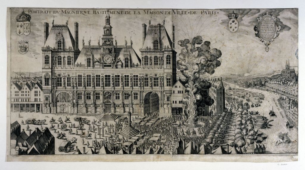
In spite of all of that controversy, the new neighborhood continued to grow and became the preferred enclave for wealthy magistrates, parliamentarians and financiers throughout the 17th century. Louis Le Vau, one of Louis XIV’s chief architects was tasked with constructing some of the greatest examples of 17th century hotels on the island including the Hôtel Lambert. Louis’s brother, François, the creator of the eastern façade of the Louvre, is credited with drawing up the first plans for l’Église Saint-Louis en l’Île. Both brothers, worked alongside their stonemason father, building houses on the island.
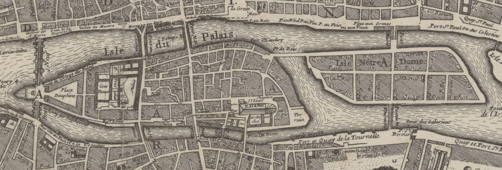
The street plan for the island is virtually unchanged and remains much as it was when the roads were first planned out in the first quarter of the 17th century. Both of the original bridges run along a central axis that divides the island roughly along its mid-point with Rue des Deux Ponts providing the route on the island between the two bridges, and Rue Saint-Louis en l’Île laid out along the east/west axis. Both Rue Poulettier (at the site of the former channel dividing the islands) and Rue le Regrattier (It’s northern portion was Rue de la Femme-sans-Teste from 1680-1870) run shore to shore paralleling Rue des Deux Ponts and running at right angles to Rue Saint-Louis en l’Île. Rue Budé (originally named Rue Guillaume) and Rue Bretonvilliers both run southward off the east west axis towards the left bank. These streets were all part of the original plan for the island, but their perpendicular layout was unusual for the period.
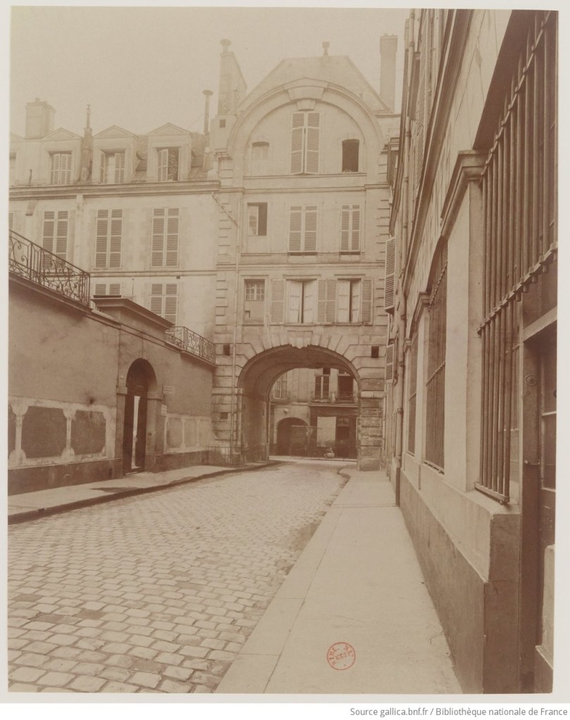
Though there were no major changes to the street plan of the island until the 19th century, the island, its streets and quais were renamed during the Revolution. During that time the island became l’Île de la Fraternité. Rue Saint-Louis became Rue de la Fraternité, Rue Poulettier became Rue Florentine, and the quais were renamed Quai de l’Union, Quai de la République, Quai de l’Egalité and Quai de la Liberté. The Revolution also saw the beginning of the dismantling of the magnificent Hôtel de Bretonvilliers (shown above) on the south eastern tip of the island. In 1793 the hôtel was requisitioned for arms manufacturing, and it was then sold and gradually dismantled until the last vestiges were torn down to make way for Boulevard Henry IV and the two Pont de Sully bridges. All that remains of the original estate are a small dependence at 1 rue Saint-Louis en l’Île and the pavillon de l’hôtel Bretonvilliers at the intersection of Rue de Bretonvilliers and Rue Saint-Louis en l’Île.
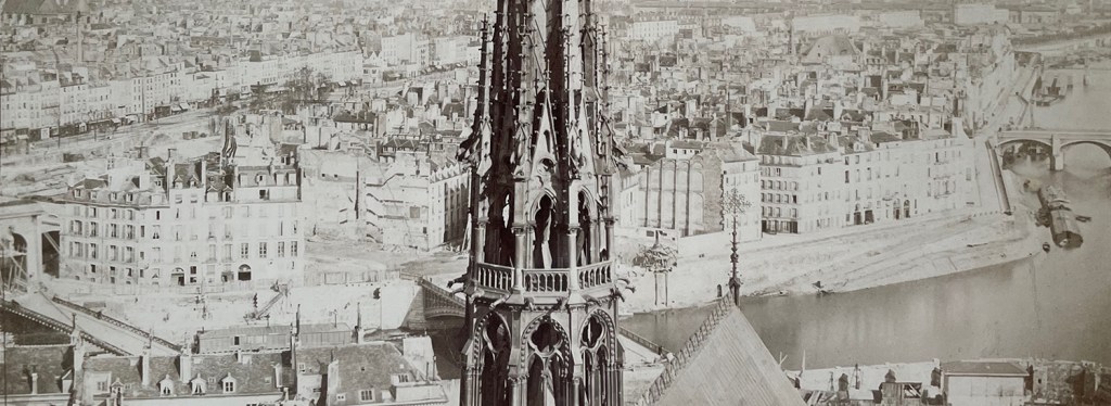
Rue Boutarel and Rue Jean du Bellay were both added to the street plan of the island in the mid-19th century. Rue Boutarel was created as a gated passage between Rue Saint-Louis in l’Île and the Quai d’Orléans in 1846 and later became a public street in 1883. Rue Jean du Bellay was created in the 1860’s to link the then new Pont Louis-Philippe to Pont Saint-Louis. Boulevard Henry IV linking both Pont de Sully bridges on the eastern end of the island is also a 19th century addition linking the right and left banks of the Seine at the site of two former pedestrian bridges as part of Hausmann’s plan to modernize the city. Pictured below in the distance just to the left behind the flêche de Notre-Dame one can see the demolition making way for Rue Jean du Bellay linking Pont Saint-Louis and Pont Louis-Philippe.
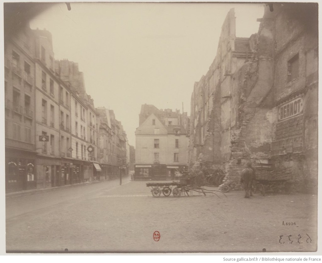
The only remaining intervention to the street plan of the island was the controversial project to widen Rue des Deux Ponts. From 1912-1930 the entire eastern side of the street was demolished to allow for the flow of traffic across the island, and it involved tearing down the historic facades on the even numbered side of the street, including such notable addresses as the Cabaret de l’Ancre which was a popular watering hole for sailors at the time. The name of the current Café l’Escale across the street at number 1 Rue des Deux Ponts is a nod to its former neighbor.
Apart from the interventions of the late 19th and early 20th centuries, Île Saint-Louis exists much the same way it did 400 years ago. But in spite of all of its history, the neighborhood is very much a living, breathing example of Paris today. There are galleries, cafes, boulangeries and markets of every type. There’s even a museum for cheese. Île Saint-Louis is an oasis in the Seine. There’s no metro, so you have to walk, or drive or Vélib’ to get here. But it’s worth the effort. It’s a vibrant village created in the 17th century in the center of a thriving contemporary metropolis. Cross the Seine and stroll the islands streets and along it’s quais. Feel its history and experience its present. It is Île Saint-Louis past and present tense.
There is more detailed history to be found in dedicated pages on this site regarding the development of the architecture and bridges of the island.
